100%
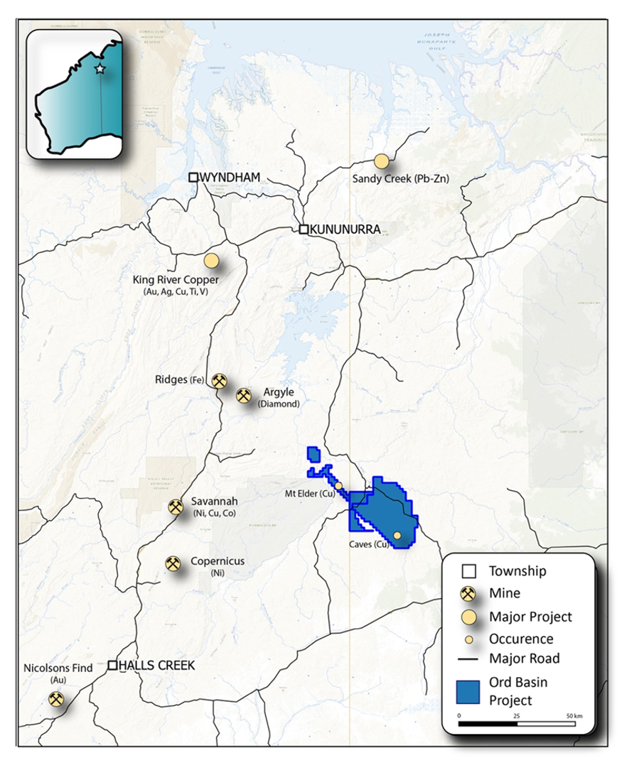
The Ord Basin Project comprises a 1,305 km2 tenement package and is located ~ 140 km south of Kununurra. Access is via the unsealed Duncan Road and to the west, the Great Northern Highway is a major arterial road that services numerous mining operations in the Kimberley region.
The Ord Basin Project is situated in a rapidly emerging district prospective for Michigan-style stratigraphic copper and Norilsk-style nickel copper-PGE mineral systems. At the Caves Prospect, historical mapping and sampling completed in 1969 identified outcropping mineralisation over an area of approximately 90m x 180m before dipping under cover.
Highly encouraging assay results were returned from initial reconnaissance fieldwork at the Ord Basin Project (the “Project”), located 140km South of Kununurra. (1)
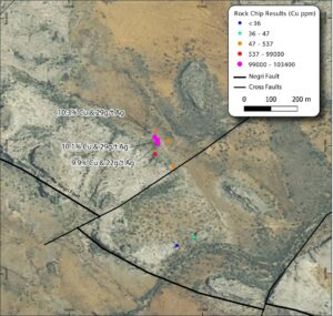
The samples returned 6 results of elevated (>350ppm) copper values, with high grade results of 10.1% Cu & 29g/t Ag (OMRK01), 10.3% Cu & 29g/t Ag (OMRK02) and 9.9% Cu & 22g/t Ag (OMRK03) returned.
The Company recently completed additional, helicopter assisted, reconnaissance mapping and sampling over the rest key target areas of the Ord Basin Project with samples enroute to the laboratory for full suite multi-element analysis and results.